Sensing Layer
- MEMS high-precision sensing
- RS485 bus / AutoID addressing
- Segmented assembly / LoRa wireless
 SoilCreate
The nerve center of every SoilCreate monitoring system: a self-developed acquisition gateway series and the SoilCreate Monitoring Cloud connect field sensors to dashboards, alerts and AI analytics — one continuous, fully owned data chain.
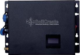
Three self-developed gateways cover wired buses, long-range wireless and vibrating-wire sensors. Data is filtered and checked at the edge, buffered locally during network loss, and pushed to the cloud the moment connectivity returns.
Anomalies are identified and flagged right at the front end, before upload.
On-board storage rides out network loss; rapid changes trigger accelerated reporting.
Solar power sized for 7 days of overcast with 30% reserve, lightning-protected enclosures, remote OTA upgrades.
RS485 bus input with AutoID auto-addressing, 4G uplink, and 16 GB on-board storage for breakpoint-resume on network loss.
1 km+ transmission range with ad-hoc mesh networking and 4G/MQTT uplink — cable-free coverage for remote, dispersed sites.
16 channels with intelligent frequency-sweep, compatible with vibrating-wire sensors from multiple vendors. 8-ch (SCSE-VW01-8) and 4-ch (SCSE-VW01-4) variants available.
Store-and-forward keeps data safe through network loss.
Ad-hoc mesh networking, no cabling required.
Intelligent frequency-sweep, multi-vendor compatible.
Lightning protection with <10 Ω grounding, −40 to 70 °C.
Field-service statistics show that most edge failures trace to power, lightning protection and APN/SIM configuration — not the sensors. That is why every SoilCreate edge device is engineered around six clearly separated function blocks.
ARM Cortex-A / RISC-V running Linux or an RTOS, executing edge algorithms — filtering, checking and anomaly flagging before upload.
Vibrating-wire frequency-sweep, 4–20 mA, RS-485, CAN and SDI-12 — one box aggregates mixed sensor fleets.
4G/5G, NB-IoT, WiFi, LoRa — plus BeiDou short message for sites with no public network at all.
Solar MPPT charging with lithium or lead-acid batteries, and DC-DC rails at 5/12/24 V for the sensor bus.
SD / eMMC buffering rides out network loss; data resumes to the cloud from the breakpoint once connectivity returns.
IP65/IP67 housings rated −40 to 70 °C, with surge protection rated 8/20 µs · 20 kA against lightning.
Panel wattage ÷ site average daily sunshine × 0.5 safety factor must exceed the device's average daily consumption — a rule calibrated on rainy-season field data. Even a 10% shortfall can mean an outage after sustained overcast.
On site, only the SIM card is swapped — eliminating the most common cause of "phantom" 4G failures: a mistyped APN.
Earth resistance below 10 Ω, with the lightning rod at least 3 m from the device. Substandard grounding is the leading cause of strike damage.
Every remote firmware rollout is validated in the lab before being pushed to cold, remote or hard-to-reach stations.
Five layers, one proprietary system — from MEMS sensing to neural-network safety assessment.
Built on a microservices architecture, the SoilCreate Monitoring Cloud turns raw sensor streams into decisions — with full audit trails: every threshold change is version-logged and every alarm leaves a trigger record.
Second-level data refresh across all measurement points, with live curves, cloud maps and period statistics.
Configurable graded alert levels pushed by SMS and app, with version-logged thresholds and trigger logs for every alarm.
Measurement points placed on design drawings, GIS maps and BIM models — see the structure, not just the numbers.
Tiered role-based permissions let owner, contractor and supervisor accounts work on the same platform in parallel.
Standard RESTful + MQTT interfaces integrate with your existing GIS, BIM, OA and regulatory supervision platforms — no vendor lock-in.
Neural-network models deliver trend forecasting and decision support on top of live monitoring data.
The platform follows the standard three-layer IoT architecture: a device layer of sensors, an edge layer handling acquisition, protocol conversion, buffering and edge AI, and a cloud layer that splits into access (MQTT / HTTP / device shadow), data (time-series + relational + object storage), algorithm (rules + anomaly detection) and application (dashboards, mobile, government access, API) tiers.
| Module | Purpose | Permission boundary |
|---|---|---|
| Control indicators (alarm thresholds) | Graded alarm threshold configuration | Writable by owner + supervising engineer only; every change version-logged |
| Project overview / cloud map | Project info, progress, measurement points on design drawings | Readable by owner, contractor and supervision |
| Daily reports | Daily monitoring summaries | Writable by the supervising engineer |
| Data summary / comparison / period statistics | Multi-dimensional queries; contractor vs. third-party comparison flags deviations >10% in red | Readable by all parties |
| Project management (staff) | Staff categories and accounts | Writable by the owner only |
| Automation management | Device status and remote upgrades | Writable by SoilCreate O&M only |
Beyond the version-logged thresholds and alarm trigger records noted above, account changes leave approval records (applicant, approver, permissions before and after), and every API call leaves an audit log (caller, time, endpoint, parameters). Together these four audit trails make any post-event review traceable to a person and a timestamp.
Integration over standard RESTful API + MQTT follows a fixed flow: requirements → interface documentation from pre-sales → customer development → joint testing → go-live. The platform already interfaces with government regulatory platforms — meeting mandates such as Shanghai's 2024 rule that automated monitoring data be transmitted directly to the supervision platform.
Three production AI capabilities sit on top of the cloud platform, turning monitoring data into early, defensible safety judgments.
Models trained on monitoring data assess structural safety state and forecast deformation trends before thresholds are reached.
Advanced denoising for GNSS time series strips multipath and orbital noise to expose true millimeter-level displacement.
Computer-vision models recognize surface defects such as cracking, complementing sensor data with visual evidence.
Submit your request without leaving the page. Price negotiation stays off the public catalog.
Contact: sales@soilcreate.com · WhatsApp: +86 15356046033